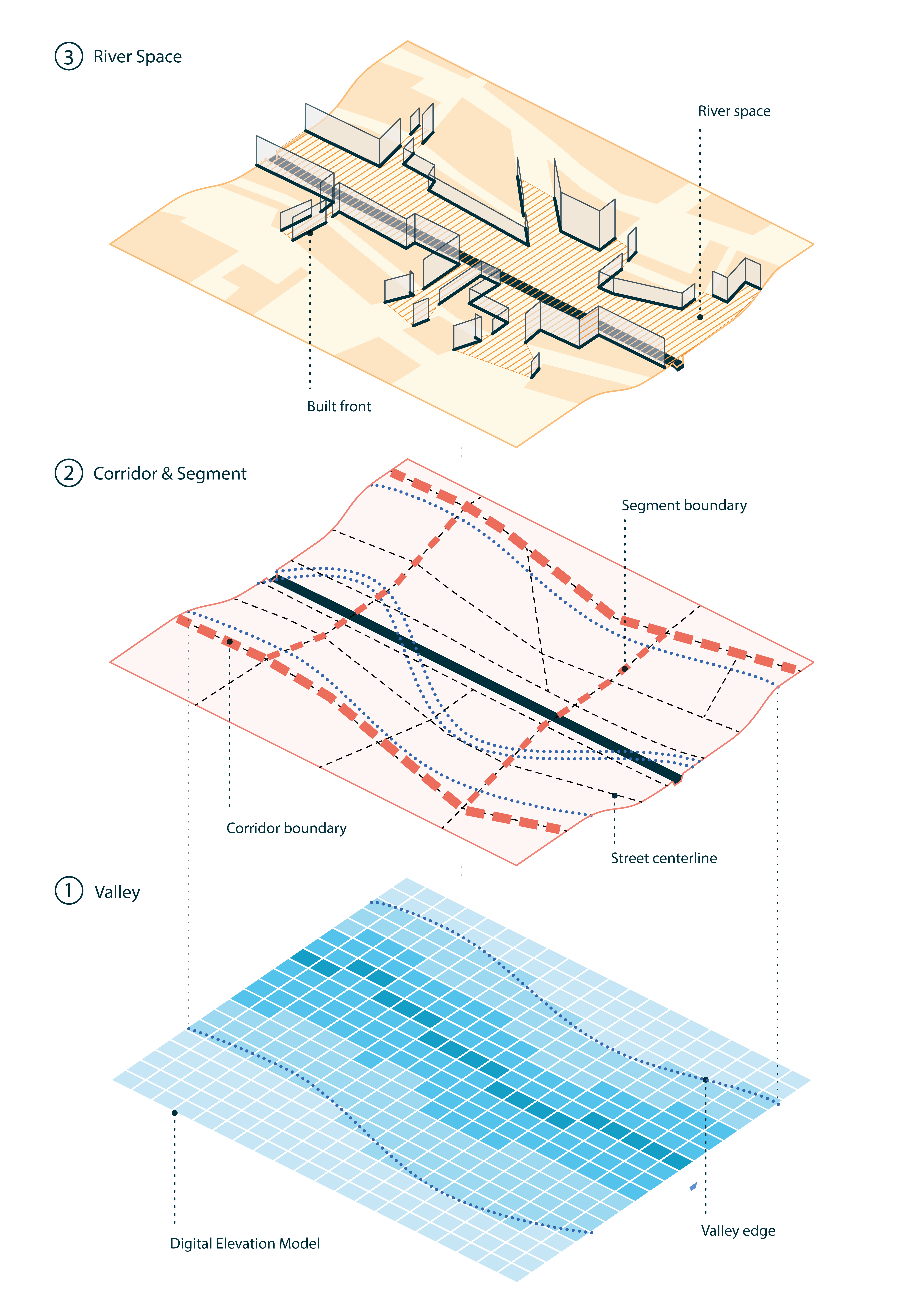
CRiSp implements a spatial morphological method of delineation (Forgaci, 2018) that considers both the terrain of the river valley and the configuration of the urban fabric, as shown in the diagram below.
The method consists of the following steps, each explained on this website in a separate article:
The valley is delineated using a cost distance accumulation analysis on a Digital Elevation Model, as shown in
vignette("valley-delineation"). The resulting valley edge is used as one of the inputs in the next step.The urban corridor surrounding the river is delineated on the street network along a path following road centrelines that is closest to the valley edge, as shown in
vignette("corridor-delineation").The delineated corridor is divided into corridor segments bounded by the main transversal streets, as shown in
vignette("corridor-segmentation").The river space, i.e., the space between the river and the first line of buildings is determined, as shown in
vignette("riverspace-delineation").